The Portuguese caravel — the ship that built the first global trade network.
Henry the Navigator's engineers designed a hull that could beat against the wind. With it, Portugal explored the coast of Africa, rounded the Cape of Good Hope, and connected two hemispheres.
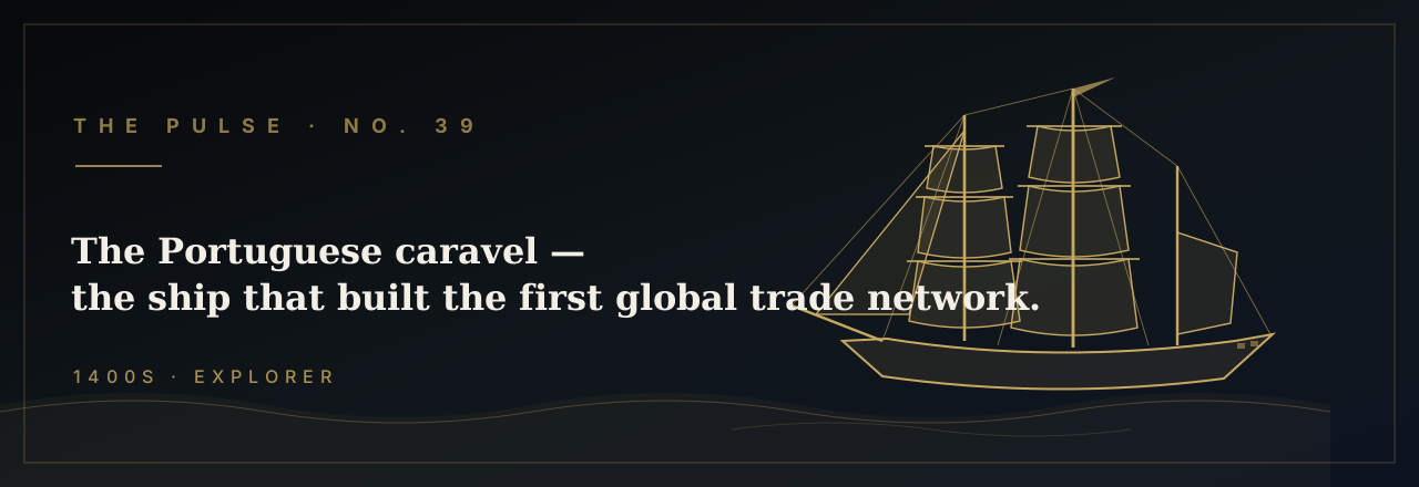
In the opening decades of the fifteenth century, Portuguese shipwrights working in the yards around Lagos and Lisbon began experimenting with a hull form that would, within a generation, render every other vessel in the Atlantic obsolete. The caravel was not large — the typical specimen ran sixty to seventy feet on the keel and displaced somewhere between fifty and one hundred sixty tons — but it possessed a quality no previous European ship had mastered: the ability to sail efficiently against the wind. Its signature triangular lateen sails, strung fore-and-aft along angled yards, allowed the hull to point as close as sixty degrees off the wind's eye. That single fact — a ship that could beat to windward and come home again — unlocked the African coast, the Indian Ocean, and, within eighty years, the Americas.
The man who understood what such a ship could mean was Prince Henry of Portugal, the third son of King João I, who established his court at the windswept cape of Sagres around 1419. Henry was not himself a sailor — he led no voyages — but he was a ferocious organizer of exploration, and he grasped a problem that had stopped every previous Atlantic venture cold. The prevailing winds along the African coast blow from the north and northeast. Any ship that sailed south could ride those winds down with ease; the agony was getting home. The return passage required beating north against the same winds that had assisted the outward leg, and the square-rigged vessels of the day — descendants of the medieval cog — simply could not do it. Henry's engineers needed a ship that could work to windward, and the caravel, with its lateen rig borrowed partly from Arab dhow tradition, was their answer.
The first great proof of the design came in 1434, when the Portuguese captain Gil Eanes rounded Cape Bojador, a modest headland projecting from the Saharan coast of what is now Western Sahara. The cape's reputation was mythological: sailors believed the shallows beyond it boiled in perpetual surf, that the sun burned men black, that sea monsters prowled its approaches. Fourteen previous expeditions had turned back at its sight. Eanes sailed his caravel in a wide arc out into the Atlantic, bypassed the cape entirely, and landed on the far side to cut a handful of wild roses before beating home. After two decades of frustration, a caravel had done in a single passage what square-rigged ships could not do in fourteen attempts. The psychological barrier of the Sea of Darkness was broken, and the systematic exploration of an entire continent had begun.
Over the following half-century, Henry's captains and their successors inched the Portuguese frontier of knowledge steadily southward, and the caravel was their instrument at every step. Diogo Cão reached the mouth of the Congo River in 1482 and left behind a limestone marker — a padrão — to claim the land for Portugal, the first of several he would plant as he probed down the southwestern African coast to roughly twenty-two degrees south latitude. Each expedition followed the same operational logic: run south before the trades, explore, and exploit the caravel's windward ability to claw north on the return. The Portuguese also discovered the volta do mar — the "return of the sea," a great clockwise gyre of wind and current in the North Atlantic — which allowed outbound ships to swing far west into the open ocean to pick up westerlies for the homeward passage. They guarded this secret for decades. The caravel made it possible; the navigators refined it into doctrine.
The culmination of this southward campaign arrived in the winter of 1487–1488, when Bartolomeu Dias and a fleet of three vessels — the caravels São Cristóvão and São Pantaleão and a supply ship — were driven south by a violent gale for thirteen days and emerged, when the storm cleared, into water running from west to east rather than south to north. Dias had, without seeing it, rounded the southern tip of Africa. He sailed east and then northeast along an unfamiliar coast, landed at Mossel Bay, and pushed on to the Great Fish River before his exhausted crew refused to go further. The return passage confirmed what the geography demanded: he had rounded what he first called the Cabo das Tormentas — Cape of Storms — a name King João II would rename the Cape of Good Hope, for the promise it offered of a sea route to India. The caravel had done what no European hull had ever done: it had closed the loop around an entire continent.
Columbus carried the caravel's technology westward in 1492. His flagship, the Santa María, was a heavier carrack, but the two vessels that flanked her — the Niña and the Pinta — were caravels, and it was their windward performance Columbus trusted above all others. When the Santa María grounded and was lost on the reefs of Hispaniola on Christmas Day, Columbus transferred to the Niña and sailed her home across the Atlantic, demonstrating once more that in a crisis, the caravel's combination of seakeeping and windward ability was unmatched. The little ship entered Lisbon harbor on March 4, 1493, carrying news that would reshape every human assumption about the planet's geography. Neither hemisphere would ever again be unknown to the other.
It was Vasco da Gama who completed the project Henry the Navigator had begun. In July 1497, da Gama departed Lisbon with a fleet of four ships, including the caravel Berrio, whose rig embodied sixty years of Atlantic refinement. The fleet swept south, made an enormous open-ocean arc through the South Atlantic to pick up westerly winds, rounded the Cape of Good Hope in November, and by May 20, 1498, da Gama had reached Calicut on the Malabar Coast of India — the spice capital of the world. The voyage shattered the Ottoman and Venetian monopoly on Eastern goods and opened a sea lane that would funnel the wealth of Asia into Lisbon for the next century. By one contemporary accounting, the pepper, cinnamon, and cloves da Gama brought home exceeded the cost of the entire expedition sixty-fold. A ship that could beat to windward had purchased a world.
The caravel itself did not survive the age it created. By the early sixteenth century, as Portugal needed vessels capable of carrying cannon and bulk cargo across intercontinental distances, the caravel gave way to the larger carrack and galleon. But the knowledge it generated — the volta do mar, the techniques of open-ocean navigation by latitude, the systematic charting of coastlines — became the common inheritance of every European maritime power. In September 1542, the Spanish explorer Juan Rodríguez Cabrillo entered what is now San Diego Bay aboard vessels whose design lineage ran directly back to the caravel yards of Lagos. He named the anchorage San Miguel. The bay that would eventually become home to the United States Pacific Fleet — the largest naval concentration in the world — was first entered by a captain whose seamanship tradition traced its roots to Gil Eanes rounding Cape Bojador with a handful of wild roses and a ship that could sail into the wind. The caravel did not merely connect two hemispheres; it taught the world what the ocean was, and what a hull could dare.
Two designs for Pulse No. 39.
Bella + Canvas 3001 unisex tee. Printed on demand and shipped from the U.S. $34.99 + tax + shipping.
Caravel Tee
THE CARAVEL · HENRY THE NAVIGATOR · 1415–1520
Wind Against the Bow
The caravel's ability to sail closer to the wind than any previous vessel.